Tropical Storm Erin Poised to First Hurricane of 2025
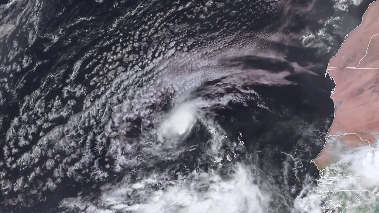
A tropical system in the eastern Atlantic has strengthened into Tropical Storm Erin, forming just west of the Cabo Verde Islands. With sustained winds near 45 mph, Erin is moving west at about 20 mph and is expected to intensify in the coming days, potentially becoming the first hurricane—and possibly the first major hurricane—of the 2025 Atlantic season.
Forecasters point to warm ocean waters, low wind shear, and abundant atmospheric moisture as ideal conditions for rapid strengthening. If Erin continues on its current track, it could reach hurricane status well ahead of the typical season pace.
Two main scenarios are in play for its path:
- If Erin intensifies quickly, it may curve northward, staying over open waters and away from land.
- If development is slower, it could track farther south, raising the threat to parts of the Caribbean.
At this time, a direct U.S. impact appears unlikely, but coastal communities along the East Coast and in the Caribbean are being urged to stay alert. Erin’s early arrival also serves as a reminder that the most active stretch of hurricane season has begun, with other tropical systems likely to form in its wake.